|
Navigation Challenges
Thursday, 18th March
From the aviators point-of-view Wednesday 17 March was a disaster.
The cloud base in Caernarfon had not got above 300 feet all day and
there were frequent torrential downpours. No flying had been possible,
and I'd had a good view of the inside of the hotel room all day. Handy
for revision for ATPL exams, but useless for any practical flying!

Thursday was better: but not by much. It was clear that a land away
was not really a possibility due to an approaching weather front that
was set to degrade the weather further in Wales. Flying today would
already be a challenge. The wind was 170 degrees at 25 knots with
regular gusts up to 35. Phil and I decided that we would fly and
that we would do some navigation exercises including diversions
and position fixes as preparation for my commercial pilots licence
(CPL) course.
We looked at the chart and decide that we'd route up the Menai
Strait to Deganwy and then Phil would provide me with diversions,
position fix and feature recognition exercises. It was going to be
just like the flights we'd done three years earlier whilst I was
training with Phil for my PPL.


The takeoff in the gusty wind provided no significant problems
and we were soon heading North East up the Menai Strait at 1500
feet. Whilst passing Llanfairfechan we noticed a very large fire
on a hill that was billowing smoke into the gloomy day. We
reported our observation to Valley Radar who, after a brief delay,
informed us that there was gorse burning in the area.
Valley did however, thank us for our vigilance.
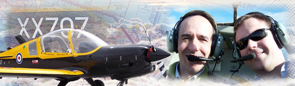
The first diversion was to Trawsfynydd nuclear power station.
I quickly determined a heading and estimated time of arrival
for Trawsfynydd, and climbed to an appropriate flight level
for the track I'd determined. No sooner had I settled into
the climb that Phil asked me to fix my position using whichever
radio aids I wished.

I selected the frequency for the Wallasey VOR/DME station
and listened to the identification Morse code. Following this,
I determined on which radial we were and at what distance, and
then used my all-in-one plotter to determine the position. Once
I had determined the position, Phil asked me to confirm this using
ground features. We were just west of Llanwrst using the town, the
four roads into the town and the river running to the West.
Then came the next question: "what is your maximum drift on this
heading given the forecast wind?" The forecast wind at this level
was 195 degrees 45 knots and I knew the maximum possible drift
(tracking at 90 degrees to the wind) at our speed of 100 knots
was 23 degrees, which I had rounded up to 24 for ease of mental
arithmetic. I knew this because I always mark the maximum drift
on the chart along with the wind vector: another of Phil's top
tips during my PPL training.

In the air there is not really enough time to use a flight
computer to determine the drift, so estimates have to be
made. More top navigation tips taught to me during my PPL
were the 'drift star concept' and 'clock face technique',
which allowed me to quickly determine that on a heading of
210 I should use one quarter of the maximum drift of 24
degrees. This gave me 6 degrees drift on our present
heading. Performing the calculation with a navigation
computer in fact gives 10 degrees, but for a quick
estimate that can be made in the air, 6 degrees is not a
bad.
We arrived overhead Trawsfynydd and the next diversion was to
Pwllheli. A similar affair ensued with the track and estimated
time being determined, and a position fix been obtained near
the middle of the leg at Criccieth.

By this time the weather was closing in a little and we elected
to route back to Caernarfon for a debrief and a cup of tea and
wait for the approaching weather front to pass. Once again as
we descended into the turbulent layer below 2000 feet we were
in for a bumpy ride. We joined downwind left hand for runway
20 and the wind was now 160 degrees 29 gusting to 39 knots:
a crosswind component of 18 knots in the steady wind and 25
knots in the gusts. This would be a very challenging landing,
but by no means impossible in an aircraft as capable as the
Bulldog, which has a demonstrated crosswind landing capability
of 35 knots!
After a bumpy final approach and a very careful flare,
we touched down and brought the Bulldog to a walking pace
on the runway. We taxied straight to the apron and parked
in front of the hangar, with the added bonus that the hangar
shielded the aircraft from the brunt of the wind. Just to be
sure however, we inserted the control locks to prevent the
elevators and ailerons flapping around in the wind. By now
the rain had started in earnest, and we both ran inside for
a well-earned cup of tea.


In the café I drew the route that we'd flown onto the chart
and compared the headings and timings with what we'd actually
achieved. As it turned out we'd been fairly accurate on most of
the route, but the leg between Deganwy and Trawsfynydd had
taken 29 minutes: about five minutes longer than the theory
would suggest. This was possibly due to the wind, which was
practically all headwind on this leg, been stronger than forecast.
After the weather front had passed and the heavy rain had stopped,
Phil and I decided that we'd make one more flight. This time we'd
tour Anglesey from the South in a clockwise sense. This would be a
flight at low level in weather that was just barely visual flight
rules (VFR). The visibility was about 4km and the cloud was overcast
at 1500 feet and few at 500 feet. We'd transit Anglesey at 1000 feet
in the murky and bumpy weather as an exercise in low-level navigation
in poor weather.
Despite the dreadful conditions, the flight was proceeding well and
the aircraft was coping superbly. Holding the height
at 1000 feet was not difficult despite the regular turbulence, and the
airspeed fluctuations were manageable. Once again the Bulldog was
demonstrating its immense capability.
We asked Valley for a MATZ transit at 1000 feet, which was approved.
This enabled Phil to get a photograph of the airfield as we passed
overhead. Despite being only been at 1000 feet, there was so much
moisture in the air that Valley was partly obscured in the mist.
We continued to the North past Holyhead and routed to the coast at
Amlwch, carefully avoiding the restricted airspace at Wylfa nuclear
power station on the Northern coast of Anglesey. We made several
orbits at Amlwch for our friend and fellow pilot Andy Reay to see,
as he was working in Amlwch that day.
Routing back down the Menai Strait the ride was getting bumpier,
but Caernarfon was now in sight. We couldn't see the mountains now,
and from this we estimated that the visibility had deteriorated in
the hour since we'd departed. We changed to Caernarfon Radio from
Valley Radar and, as the circuit was clear, we elected for a straight
in approach to runway 20. The wind was a little stronger now at 32
knots, but the gusts were not as significant as they had been earlier.
The landing was smoother than the previous one, and the fact that the
wind was now practically straight down the runway helped greatly.
We'd had another good day out, but this time in poor weather. Most
definitely though this kind of flying had been beneficial and had
further improved my confidence in marginal conditions. Back in the
café, I responded to the telephone messages I'd received regarding
the evening dinner at the Garden Chinese restaurant in Bangor.
After signing the paperwork for the days flying, I headed back to
the hotel to make myself ready for the evening out.
|