|
Sherburn - Shobdon - Old Sarum - Sherburn
Sunday 13th July -
Flight Planning
The previous Thursday Chris, our CFI, sent us the crew details for the away day.
There were going to be four planes, 3 instructors, 1 safety pilot and 12 private pilots
with varying degrees of experience. I'd been allocated the outbound Shobdon leg in
Charlie Romeo and had to plan this in both directions. The wind direction on
the day would determine which way round we flew the route.
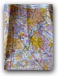
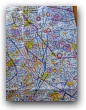
So I downloaded the relevant NOTAMS from the AIS web site
and started planning the outbound route from both Sherburn
& Old Sarum. I realised I'd have to finish off both plans
at the aero club as I wouldn't have the wind forecast until
6.00am UTC (i.e. 7.00am) the next morning.
Monday 14th July
I dragged myself out of bed at 5.30am in order to make sure I got a cooked breakfast
inside me and still have time to drive over to Sherburn (via the M62) for the 8.00am briefing.
At 6.53 I managed
to print off the UK Low Level Spot Wind Chart Forecast (F214) & the Forecast Weather
below 10,000 ft (F215). It wasn't going to be too windy aloft, but the
cloud base could be as low as 1,500ft and rain would definitely be moving in from the west.
As I set off for Sherburn I could already see the grey westerly clouds.
When I arrived at the club around 8.10 am, the car park was nearly full, I was late.
I needn't have worried. Everyone was in the final stages of their flight planning
and I parked myself in one of the classrooms with a pilot I'd met on the France
trip who advised me we were doing the Shobdon leg first. I sanity checked my
route with Chris and he advised me that the inbound leg from Old Sarum was up
for grabs if I wanted to do it. I agreed and then realised
I'd have to get the flight planning done somewhere between flying the
first and third legs!
I worked out the average spot wind for the area we'd be flying in (270°/08)
and, after completing my calculations, co-pilots Tony & Richard
found me and introduced themselves. We decided to check the weight and balance
given there were four of us and all our flying paraphernalia and
worked out we'd be overweight by a few pounds, but still in balance. Richard then
checked whether we'd have enough take-off run on 29 tarmac. That was fine too.
Sherburn -
Shobdon
Before going out to the plane I completed Charlie Romeo's log sheet and Dale,
one of the club's instructors, asked me how I was getting on.
I confided I was feeling quite nervous.
He assured me, what I instinctively knew from my QXC etc,
that once up there I'd enjoy it.
After doing the external, internal, taxi and line up checks we took
off from runway 29 tarmac. Given the
load, I closely watched the airspeed and shortly after take-off found
it was approaching 60 knots (heard the stall warning briefly cut in) so
lowered the nose to get it up to 75 knots.
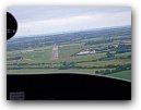
The air was quite smooth as I wended my way between Sherburn in Elmet and Steeton Hall turning
south at the motorway. As we crossed the MATZ boundary I
advised Sherburn we were departing Sierra (i.e. not above 1,500 to the south via Ferrybridge).
At Ferrybridge I changed frequency and passed my details to Doncaster Radar.
Following their response I set the altimeter to the Doncaster QNH and
the transponder to the assigned squawk code. Then I turned
onto my calculated heading (given the wind and magnetic
variance) for Derby (195°) and noted the time (9.55).
My first pin point was Sheffield City airfield (now sadly closed) with an ETA of 10.07.
As we flew south the weather deteriorated and Chris quickly
challenged whether I should stay at 2,000 ft given the clouds rolling towards us!
I reduced power
and descended to around 1,800 ft. At 10.07 we made the first pin point on track so
now I could be confident the wind I'd factored in was accurate.
Prior to Derby I requested a frequency change to East Midlands. I reset the altimeter
to the Barnsley QNH and then dialled in the new squawk code. We arrived at Derby on time
and changed heading for Stafford at 10.25. At this point it brightened up a little bit and shortly
after turning I was advised that there was traffic crossing left to right in front of me
at the same level. I quickly clocked a black helicopter about a mile ahead and reported
'visual with traffic'.
Further down the leg I spotted a Cessna coming towards us at 11 o'clock and below us.
Before I could decide whether or not it was ascending, it skidded out of view underneath us and to the
right of us. Chris advised me that the sighting was an 11 o'clock 'low' as opposed to 'high'.
Without that piece of information he hadn't known whether to look ahead up or down. He also pointed out
that the ATC had probably been too busy to advise us of this traffic - hence a Flight Information Service
is just that. It's still the responsibilty of the pilot to keep a good look out.
Excitement over, we arrived at the pinpoint for this leg (Utoxeter racecourse) on time at 10.35. At
Stafford I was asked to change frequency to Shawbury Radar and turned onto a heading for Kidderminster.
At this point the weather deteriorated further and we heard over the radio that two of our pilots
flying separately in a Cessna were heading back to Sherburn due weather. My brain reeled
- was that the Cessna we just clocked eyes on?
En route to Kidderminster I remained at 1,800 ft, just clear of my safety
altitude and safely below the clouds. But then I realised this would take me into
Wolverhampton's ATZ. I advised Shawbury I was changing frequency to Wolverhampton
but didn't make clear that the change was only temporary so they asked me to squawk
the conspicuity code 7,000. Chris quickly clarified with them my intentions. I
changed frequency to Wolverhampton and requested zone transit at 1,800 ft. They
were absolutely fine with this - the airfield wasn't active. At the southern
side of the ATZ I advised Wolverhampton where I was and that I was changing
frequency back to Shawbury.
With that out of the way I could focus on my next waypoint - the lake south
of Kidderminster. We arrived on time at 11.05 and I turned onto my final heading (260°)
for Shobdon. The track skirted hills to the south and the landscape in front of me
was very bland compared with the rest of the route. I'd earmarked a pin point only
five minutes down track - Hanley airstrip. After a few minutes I started looking out for
it and I picked out a field that resembled an airstrip
but wasn't a hundred per cent sure. Thinking about it afterwards, Tenbury Wells and
the village to the south of it would have been a much better pin point.
I kept on my heading and Chris pointed out we were tracking roughly the same direction as the
runway. With that thought in my head I peered into the distance and made out a brownish
strip pointing towards us. I changed frequency to Shobdon and requested
joining instructions - 'overhead for 27 left hand'. I descended on the dead side and crossed
the 09 threshold at 1,000 ft, then steered slightly right to make sure I got behind Pembridge village
on the downwind leg. I looked over my shoulder to validate where I was relative to the airfield,
made my downwind call and did the pre-landing checks.
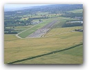
I then flew past the second village before turning onto base and reduced power. As soon as the
airspeed allowed I set the first two stages of flap. Everything was fine so far. At
around 800 feet I turned onto final and at 300 ft lowered the drag flap and set the
carburettor heat to cold. Chris prompted me to aim for the numbers, which I duly did
and then I flared - but too high I realised as I levelled out. In the hold off I
ballooned and added a trickle of power
to cushion the inevitable descent. A few moments later we were safely on the ground!
On reflection I realised the perspective of the runway had foxed me - it had appeared
quite wide because of the grey\brown verges either side and therefore the surface seemed
nearer than it actually was and I hadn't compensated accordingly. (Ground School -
Human Factors & Pilot Performance:
Eyesight & Visual Allusions).
I parked up behind Delta Echo and did the close down checks. Then we all went across
to the club for a welcomed cup of tea. I booked in Charlie Romeo,
paid the landing fee and then made a beeline for one of the large tables
so I could spread out and do my flight planning for the third leg (inbound to Sherburn
from Old Sarum). There I got talking to Selwyn, a qualified private pilot from Mirfield.
Then Chris decided in view of the weather we'd not go as far as Old Sarum, but
instead head for Sywell (home of the Blades - I recalled their spectacular visit
to Sherburn for the Emmerdale filming last year on the day I was taking my
final ground school exam). The plan subsequently changed again
as Sywell was closed for the day and we finally decided to route to Turweston
having checked they could accommodate four PA28s and feed us.
Shobdon - Turweston
On the next leg it was Tony's turn to fly. He was going to undertake
some instrument training. The two VORs were set (HON 185° radial from
and DTY 090° radial from) to provide a fix just south of Stratford upon
Avon overhead Alscot airfield.
After taking off Tony got onto his easterly heading, said farewell to Shobdon and
called up Birmingham Radar. By now we were in the clouds. He requested a Radar
Information Service and, after dialling in the squawk code, was advised that we
were 35 miles South West of Birmingham and they could only provide
a limited RIS (limited information regarding traffic from below or behind).
I had only ever done (in total) less than fifteen minutes instrument training and
couldn't imagine how high his workload must have been flying under IMC for an hour or so.
It must have been exhausting!
Eventually we descended towards Turweston via Silverstone and came out of the clouds.
We heard over the radio that the others were in front and staggering their
approach to the airfield by undertaking an orbit over the race course. Tony changed
frequency to Turweston for airfield information and we were asked to join on
right base for 27.
Turweston - Sherburn
By the time we reached Turweston, most of us hadn't eaten so before anything else we
put in our food orders. I then set about my flight planning. There was a nice straight route
up to Gamston VOR but it would take me through Husbands Bosworth's gliding area (active up to 3,600 ft)
through East Midlands CTA section starting at 1,500 ft and possibly, depending on the
cloud base, through Leicester and Nottingham's ATZs.
Instead I opted for a series of dog legs up to Gainsborough and back to Selby. I decided to fly
to Pittsford Water a couple of miles north east of Sywell, then Melton Mowbray, Newark on Trent,
Gainsborough and Selby. This wasn't the most elegant route but would keep me out of East Midlands
(usually very busy) airspace and clear of the main obstacles on route.
However this plan wasn't without its drawbacks when attempting to fly by dead
reckoning alone, I was soon to discover!
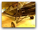
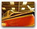
The airfield staff were very friendly and provided us with an informal tour
of one of their hangers containing a very interesting collection of planes.
Having eaten well, stretched
our legs and got the planes re-fuelled we were ready to set off for the last
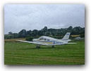
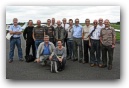
leg. At that point the flight desk manager offered to take a group photo of us out
on the tarmac.
We took off at 16.30 from Turweston. I got onto my first heading for Pittsford Water
at 16.35 and arrived a minute or so early. Then I turned onto my new heading (357°)for Melton Mowbray
with a pin point of Market Harborough at 16.49.
At this point I did a FREDA check and continued to the next waypoint whose ETA was 17.05.
However prior to the allotted time when I peered through the gloom for Melton Mowbray
it was nowhere to be seen and East Midlands suddenly asked me to change frequency to
Cottesmore which puzzled me. Was I was off track and heading for their MATZ stub?
Cottesmore was incredibly difficult to understand and Chris prompted me to request a MATZ
penetration. It soon dawned how far off track I was with a tall
mast to the left of me and an airfield to the right. My instinct was to
turn left towards my original track, but the wind was coming from this direction
so I could have ended up flying into gliders as well as getting even more lost.
Chris pointed out that it was imperative I didn't just jump to conclusions as to
where I was. Since my last waypoint I noted I'd been flying
for 17 minutes so I scanned an arc 10° either side of my track and confirmed I was just
north west of Saltby gliding base. Using the standard track correction method
I changed my heading 20° (double the track error) to the left. After the same
period of time I was heading back to my track but slightly east of Gainsborough
(i.e. still east of track) at 17.19.
I then changed onto my heading for Selby and again found myself right of track for
my next pinpoint, Sandtoft ATZ. On the next FREDA check I realised I'd set
the DI incorrectly on the previous one which accounted for some of the
track error. To get to Selby I adjusted my track again by another 20° left
which got me there at 17.40.
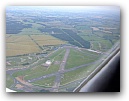
At this point I requested a radio frequency change from Doncaster to Church Fenton,
who had gone home for the day and realised, being Monday, no-one would be at home at the club either.
So I had to decide which runway to land on for myself. As I flew over the airfield I looked at the
windsock. There was a slight crosswind on 29 but the wind was straight up 24. I made all
the usual radio calls in case anyone else was either in the circuit or joining overhead and
finally landed on 24. I was both exhilarated and exhausted, having spent 3.5 hours flying that day.
Afterwards we debated the route I'd planned and came to the conclusion that
some of the legs had been far too short and a pinpoint of less than 10 minutes was
frankly useless. I'd set myself up for being way too busy most of the
time. At home I pondered what else I could have done and figured
that maybe I should have tracked direct to Newark on Trent (63 miles) from Turweston and used
Market Harborough (27 miles) Melton Mowbray (44 miles) as pinpoints en route.
It might have taken me closer to Husbands Bosworth (gliding)
than I'd like to have been, but overall would have required far less work.
Then I possibly wouldn't have made the error with the DI setting
in the first place or would have picked up on it much sooner. A salutary lesson.
|